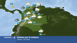
What can be seen?
- Weather condition
- If possible, we calculate a weather symbol from the measured values of the weather stations, which depicts the current weather conditions.
- Temperatura
- The air temperature is measured at a height of 2 metres above the ground. The temperature sensor is protected from solar radiation and is also partially ventilated in order to measure values as accurately as possible without heat radiation. We calculate the minimum and maximum air temperature throughout the day.
- Presión atmosférica
- The air pressure is reduced to sea level so that the values from the stations at different altitudes can be compared. Regions with low air pressure usually get unsettled weather with wind, rain or snow. Regions with high air pressure are usually characterised by dry weather and sunshine. The average air pressure is 1013.25 hPa.
- Humedad
- Air humidity indicates the quantity of gaseous water present in the air, in relation to the maximum possible water vapour content (which depends on the air temperature), i.e. the value at which the air reaches saturation point. When the humidity reaches 100%, the air is saturated and dew, fog or clouds form.
- punto de rocío
- The dew point is the temperature at which the air can cool to 100% humidity. If the dew point is reached, fog or clouds will form.
- Sol
- We cumulate the measured sunshine duration over different periods of time.
- Precipitación
- This measured value shows the amount of precipitation that has fallen. This can be rain, sleet, snow, sleet or hail. Precipitation in solid form (e.g. snow) is shown here in melted form in millimetres, provided the weather station has a heater.
- Fresh snow
- The amount of fresh snow that has fallen in the last 24 hours is generally measured once a day, often in the morning at 07:00.
- altura de la nieve
- Depending on availability, we show the snow depth at 07:00 or an average for the period. This is the thickness of the lying snow cover. Fresh snow usually increases the snow cover. Warmth, sunlight or rain reduces the snow depth.
- dirección del viento
- The wind direction is the direction from which the wind is blowing. The wind arrow points in the direction in which the wind is blowing. A circle means that there is no clear prevailing wind direction.
- velocidad del viento
- The wind speed is normally an average value over 10 minutes. The wind is measured at most stations 10 metres above ground and in an open field without obstacles.
- Ráfagas de aire
- The gust value is the highest briefly measured wind speed of the respective period. We speak of a storm from 75 km/h.
The map shows actually measured weather parameters - current measured values or cumulated over hours. The measuring stations report different measured variables at different intervals. In addition, the measurement networks are not equally dense in all countries around the world. This is why the map of measured values, which is available for all countries in the world, is not always filled with the same data in terms of time and space.
Click on the measured value of the respective location to access the detailed overview of the weather station's measured values.
The measurements comply with international standards wherever possible. Cumulative periods are only calculated if sufficient individual measurements are available. Since much of the measurement data is collected and processed automatically, errors cannot be ruled out. MeteoNews AG accepts no responsibility for the completeness and correctness of the measurements shown. For information or data requests, please use our contact form.